
Yesterday, just in time for the last days of the World Pride Madrid 2017 international party that is taking place in the capital to celebrate LGTBI pride, Apple Maps has been updated and offers, from now on, information about the different public transport available in the city. This means, bus lines, metro and commuter lines.
Finally, if you have an Apple device, be it iPhone, iPad or Mac, you can create routes and learn how to get around using public transport in the Spanish capital. Apple is thus updated to something that Google Maps has been doing for many years, so it finally begins to be a serious competitor of the Mountain View app.
Finally, the native Apple application can be used if you want to use public transport. Until now, when selecting a destination in Maps and choosing the option of how to get there, when we looked at the public transport option it told us that it was not available.
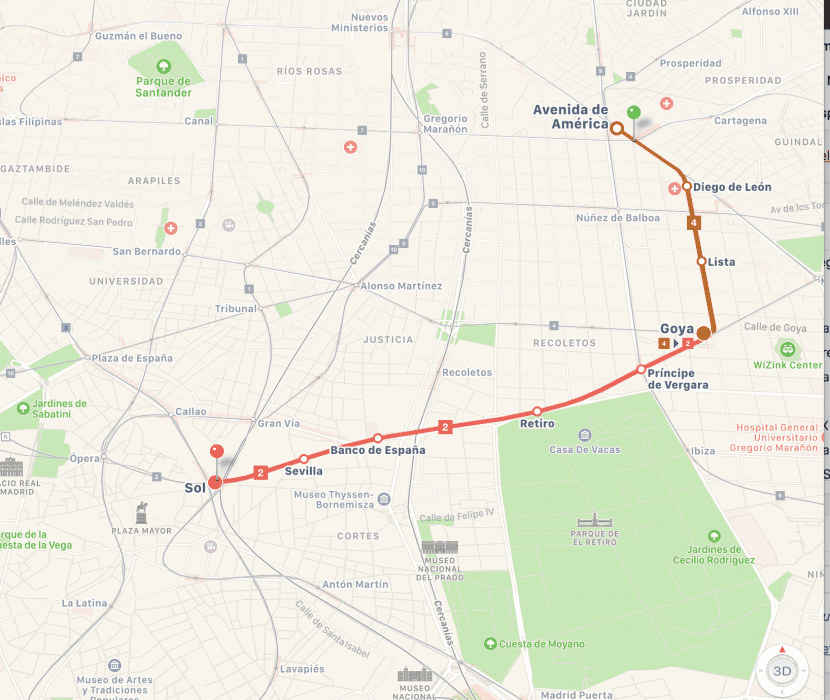
Example of a route in Madrid, from Avda. América to Puerta del Sol.
Since yesterday afternoon, and taking advantage of the World Pride Madrid 2017 pull that is taking place these days in the city, Apple has been quick to meet one of the most demanded requirements by users of Spanish Maps.

Main public transport in the city of Madrid, finally available in Apple Maps
Hopefully this means that little by little they will update the rest of the Spanish capitals, since so far and unfortunately for the guys from Cupertino, Google has a clear advantage in this regard.
To use it, you just need to have the application and enjoy it. You don't need to have iOS 11 or macOS High Sierra installed.

It has been able to be used since June 28, therefore it takes much more days than you report.