
Another interesting option that we have available in the Maps application of OS X Mavericks in addition to the option to create a PDF of a specific area of the map, is to observe traffic jams, accidents, cut roads or even sections in existing works on our route when we have to go out by car. Its operation is really very simple and useful, the only drawback that we can find with this Maps function is that the updates of the state of the road may have some delay to update but still, it is great to get an idea of how we will find the interurban roads or highways that we have to travel on.
To see all this data in the Maps application of our Mac, it is as simple as following the steps that we will see below and take advantage of the information to avoid traffic jams or problems before leaving our own home or work. Let's see after the jump how to activate the option.
The first thing we have to do is open the Maps application and click on the car symbol that appears in the upper left part of the window:
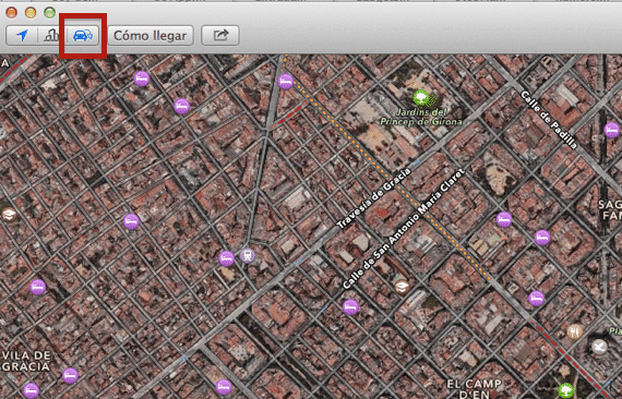
Now We already have activated the function of showing traffic and road incidents. We will see how a series of dotted lines in some specific sections of the map where there is a traffic jam, such as this:
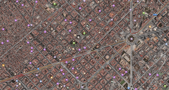
Jams typically appear in two colors: red for important retentions and orange to indicate that traffic is dense on the road.
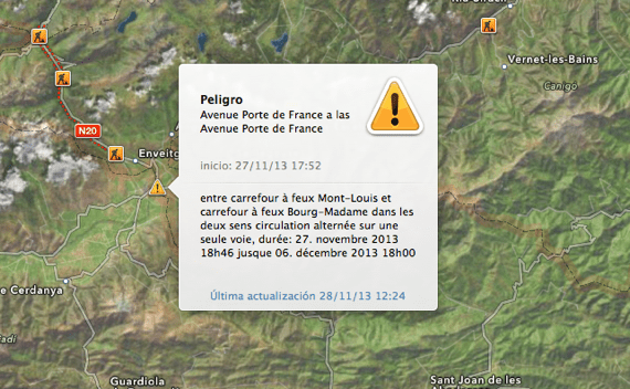
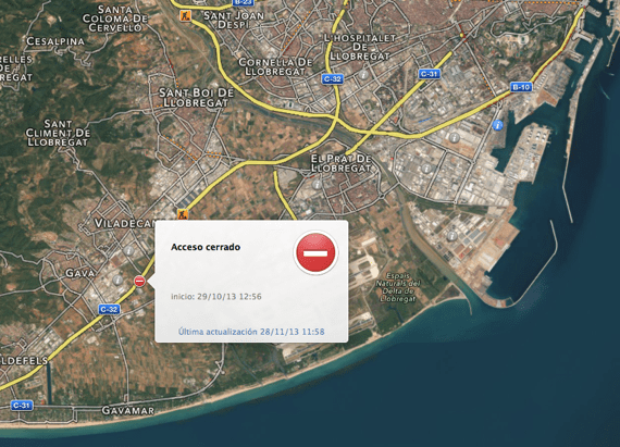
In addition to these dotted lines that show us the traffic density, we find various symbols:
- Notice for road works with a typical orange symbol for road works
- Roads closed with a forbidden direction symbol
- Accidents a red icon with a car
- Yellow triangle to announce changes in the road of all kinds, such as unusual signs.
In all these icons we will always have available when we click on it, the date of its update and even the time from the last update as you can see in this example:
This traffic option works when we have the tab selected in Standard or Hybrid within the application, does not work when we observe them in Satellite. It is obviously available for the Maps application on devices with an iOS operating system.
More information - How to get a PDF image from the Maps app